
The other day I was Googling something, I don’t remember what, when – as so often happens – I ended-up at a site which seemed to be unrelated to my search. But this was A Good Thing.
It was the website of a bar and restaurant in Khanom, the resort which is less than thirty minutes north of me. It looks nice. I must visit sometime. But that wasn’t what caught my eye.
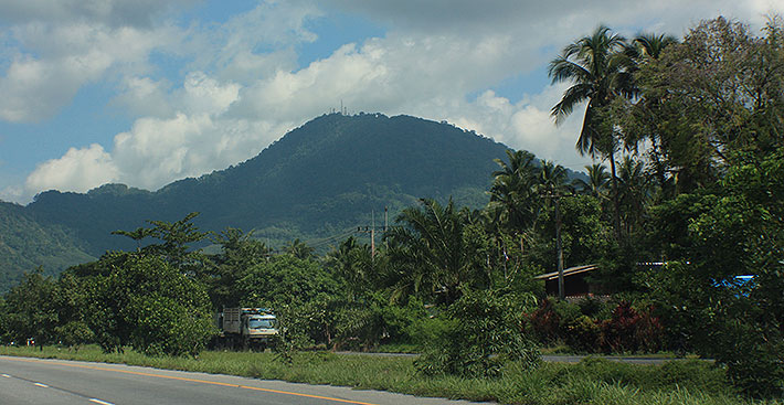
One of the pages mentioned a road up a mountain just inland from Khanom. It goes up Dat Fa Mountain, from sea level to 750meters. That’s quite a climb. For me, that’s like honey to a bee. Road? Mountain? Up? Where do I start?
And then the webpage kind-of spoiled the fun a little by saying the road was very narrow and best suited to motorcycles. What? I’ve just bought a pickup truck so I can go exploring anywhere anytime, and you’re telling me I should have bought a bike?
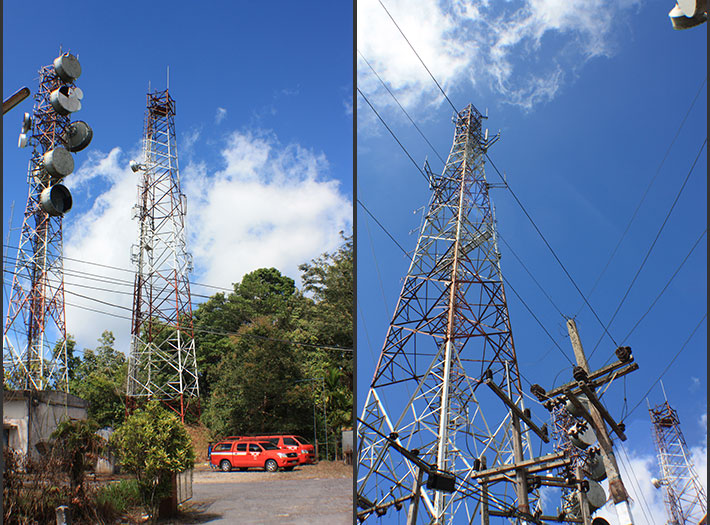
Never mind. I figured – at least I could take a look. The webpage mentioned something about telecommunications towers at the top, and I figured they didn’t get there on the back of someone’s motorbike.
So, this morning – for the first time in a couple of weeks – the weather looked spectacular. I decided I’d better get out early before it changed. From the main highway I could see the towers, and figured that must be my destination, given a little luck.
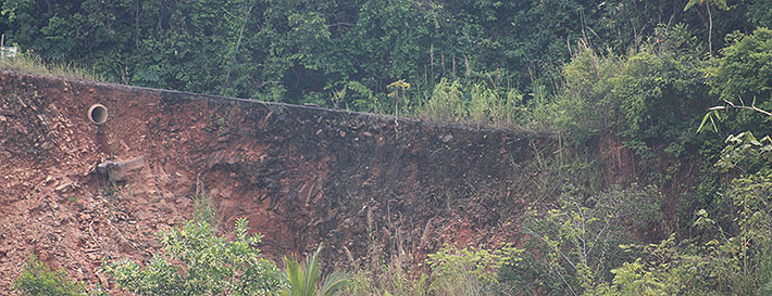
Actually, when I arrived at the bottom of the mountain road, I realized I’d been there before. I’d stopped and thought, as I do, I wonder where that goes? But, seeing some faded red signs, a very narrow road which seemed to be partly washed out, and the fact I was driving the Honda Shitty, I decided not to try it. That was a smart decision.
Today, driving Bert – my new Ford Ranger – I was ready to give it a try. As it turned out, it was only a small section at the beginning of the road that had suffered some kind of landslide. So, I closed my eyes as I went up that part! Any five year-old will tell you nothing bad can happen when your eyes are closed. Ms. Chuckles, my GPS lady seemed to know about the road, which was good news, and announced it was 7.5kms to my destination.
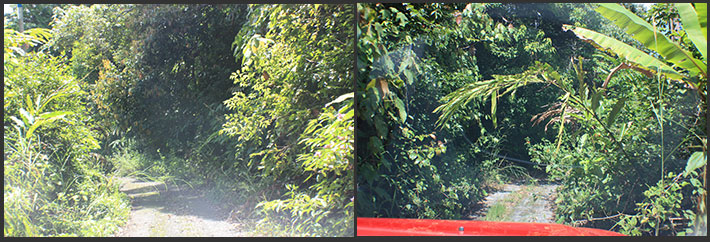
The beginning part wasn’t too bad. Sure, the road was narrow and steep, but nothing to set the pulse racing. I have no idea what would have happened if I’d met another vehicle. But as always seems to be the case when I go exploring, I met no one.
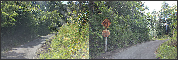
After about 2kms though, the road became very overgrown. It seemed like nothing had been up there in years. Bert was getting scraped on both sides and the roof. In a few places there were hanging tree branches which could have punctured the windshield. Care was needed. Pulse was now above normal.
But, for the next five or so kilometers it would have been impossible to turn round, not that I really wanted to. I wanted to see the top. I figured the view must be spectacular.
I started to feel like Mike Oldfield’s Man in the Rain who “Picked up his bag of secrets, journeyed up the mountainside, far above the clouds, and nothing was ever heard from him again except for the sound of … Tubular Bells!” Except it wasn’t raining and my bells are not tubular!
Eventually, with the road looking just as overgrown and narrow as it had been for the last twenty minutes, Ms. Chuckles announced “In 100 meters you will have reached your destination.” Well, I thought, 7kms downhill backwards is going to be a barrel of laughs.
But out of nowhere, the communications towers appeared – inside a small compound. The guys working there looked like they’d just seen an elephant walk in.
So, all was well. I turned around and started down.
But what about the views?
Sadly, the sides of the roads are so overgrown, it’s almost impossible to see anything. At the top, you can see absolutely nothing. Maybe I should have asked if I could climb the towers. NOT!
Driving downhill it’s easier to spot gaps, so what photos I did take, were through the trees. Given all the recent rain, the air was far too hazy for this type of sightseeing. The views were across to Khanom and the beach area. In a few photos you’ll see what I mean, but some clear air would have made things nicer.
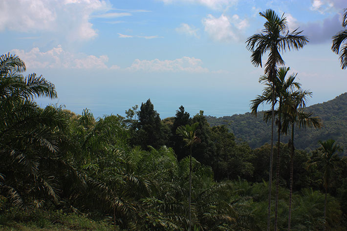
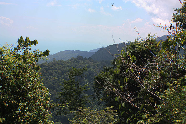
At about half distance there were some bigger gaps and clearer air, so I stopped a few times… in the middle of the road if necessary. It wasn’t like I was going to block someone. Anyhoo, if you look carefully on some of the shots, you can see Ko Samui, which seems to be hanging in mid air above the distant hills!
So, if you’re ever in the area, and wonder “What’s up that interesting looking narrow road?” now you know. It’s not worth going to the top. But the views in the first 2kms are really something, and there is a kind of lookout where you can park off the road.
 I’ll leave you with the rest of the photos. Just click on the thumbnail image and then navigate right and left. Me? I have to go apologize to Bert for getting him all scratched up. Nothing serious, nor permanent. Enjoy…


