I think it was the third time I flew from Malaysia into Surat Thani airport that I realized there were two routes. The usual one seems to involve throttling-back the engines somewhere near the border and kind-of gliding out over the Bay of Bangkok, and eventually making a gentle 180 degree counter-clockwise turn down onto the North-South oriented runway.
The second route is somewhat more dramatic. It involves the same gliding from the border, but goes directly over the central mountain range – which means being rather closer to the ground than seems sensible, especially given the turbulent air rising from the mountainous terrain – followed by a straight, but steeper descent onto the runway from the South. It’s faster I suppose, but I’d pick the sea route any day.
I have to admit though, the mountain scenery is pretty spectacular, and it was on this third trip that I noticed two bodies of water up in the hills. I made a mental note to try to find them. But my brain being what it is, it’s taken at least two years for the note to reappear.
Anyways, not too surprisingly, they are both reservoirs, and are only about 80 kms from here as the fly crows. Except, they are the other side of the mountains, and try as I have, I’ve never found a way over or through the range. I haven’t given up, but in the interest of actually reaching the reservoirs I decided it best to drive around. And at this point, I had a major decision to make…
When tootling around I always try to avoid major roads. But, to get away from Sichon, I’m obliged to use at least thirty-or-so kilometers of the 401, whether I go North or South. As far as I could figure, I could go about 35kms South on the 401 and then make a long clockwise turn on secondary roads eventually to go North up to the dams – which looked like it would be 160kms in total; or, I could could go about 35kms the other way on the 401 and then make a long counter-clockwise turn on secondary roads, eventually driving South to the dams – which also looked like it would be 160kms in total! Decisions, decisions.
And then a flash of inspiration hit me! Why not go one way and come back the other? I must have had my Wheaties that morning. But which way? Clockwise or Otherwise? More decisions. Well, clocks have been going one way for centuries, so who am I to argue.
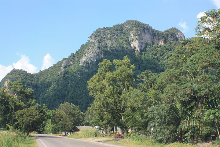
So yesterday I set out early-ish under semi-sunny skies, to travel clockwise to said reservoirs. I left Ms. Chuckles at home, as she always insists on sticking to main roads, and every time I deviate, she comes out with her standard phrase of “Make a U-turn if possible.” I didn’t need several hours of that. I’d used Google Maps to make myself some tulip diagrams and followed those instead. And just before lunchtime, after making just one teensy-weensy mistake, I arrived at the first dam – Khlong Din Daeng.
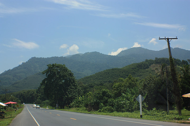
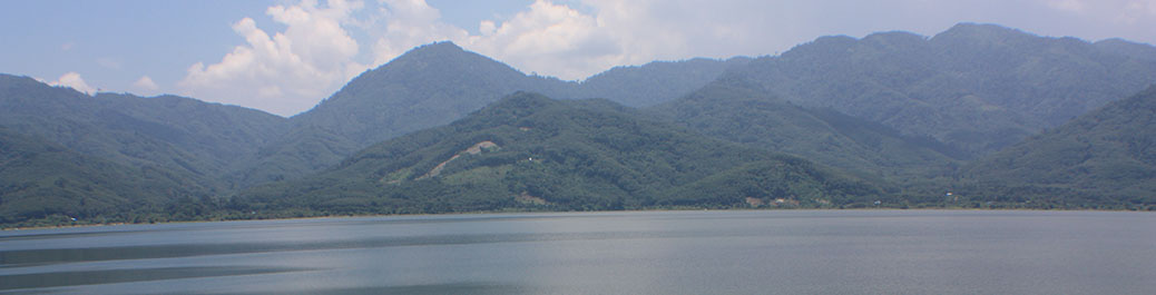
Hmm, the en-route scenery was nice, but this was spectacular. I’d only found a couple of rather rubbish-looking photos on the web, so I didn’t really know what to expect. For sure, the area is nothing like the Ratchaprapa Dam I’d visited a short while ago. None of the limestone lumps. But much more mountainous than I’d expected. Have a look for yourself…


There’s lots of small roads that run around the reservoir, but don’t go anywhere other than the small villages. So it was a question of driving alongside the water, and then making a Chuckles-inspired U-turn if possible!
I had no idea if there would be any restaurants around, and other than a couple of tiny wooden shacks there weren’t, so I’d packed myself a small picnic, and eventually found a nice tree to hide under, away from the midday sun. Bliss.
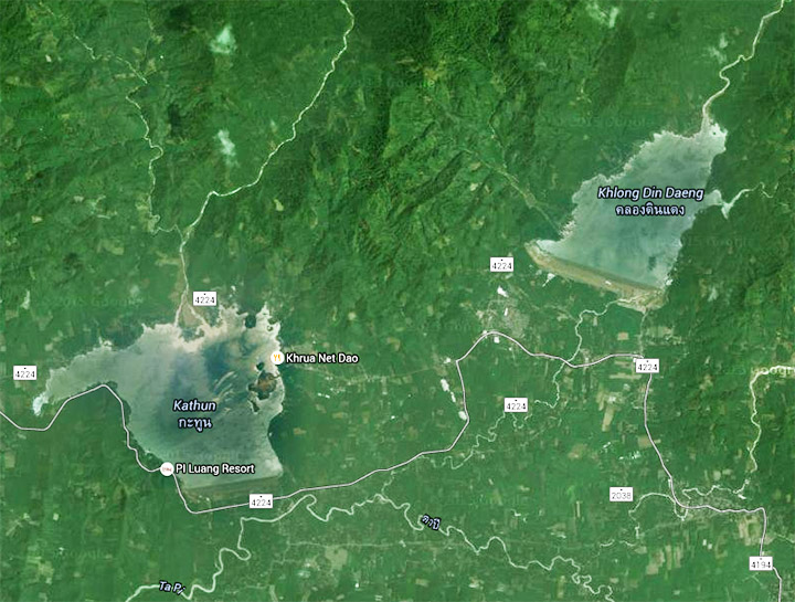
So then it was off to the second reservoir at Khatun, which was only a few kilometers away. Although similar, there were subtle differences. I’m guessing the water was deeper as it seemed to be calmer and blacker. The sort of place the Loch Ness Monster might take his summer vacation … but there was no sign of him, or her, or it.
Here’s some pix…


So after a pleasant couple of hours or so, it was time to continue the clockwise tour – crossing into Surat Thani Province for an hour so – getting totally lost in a place called Na San, which seemed to have more one-way streets than Manhattan, but zero road signs – and then back across into Nakhon and home.
 Definitely a good day out. Perhaps less cloud would have been nice, and maybe it would be possible to get better photographs at sunrise or sunset, so I could happily return some day. Although, the idea of getting up at 3am to go photograph sunrise over a lake doesn’t sound like something I’d contemplate. Sunset – maybe. We’ll see.